Drone flight planning under a SORA
With SORA constraints and the different operational volumes, requirements — which vary depending on equipment and weather conditions — are becoming increasingly complex and difficult to follow.
To simplify this process and make it accessible to everyone, Digisky has developed a planning tool that helps ensure continuous compliance with all SORA requirements.
Discover this tool and its core features here.
SORA semantic
Operational volume
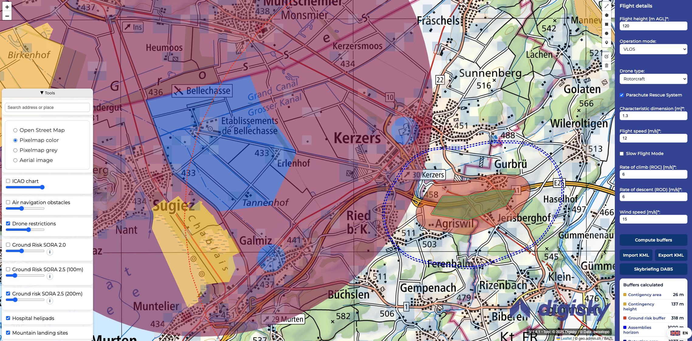
When you plan a flight under a SORA authorization, you are required to calculate and know your operational volumes. This refers to the flight geography, the contingency volume, and ground risk buffer. The size of these areas varies depending on your drone (size, speeds), your operation (altitude, VLOS, etc.), and the wind.
Before operations, a pilot must ensure that these volumes are not located in prohibited or restricted areas, which can quickly become complicated.
Digitool
The Digisky planning tool
Digisky provides a simple and efficient digital tool that allows operators to calculate and visualize these volumes in just a few clicks.
On the right side of the tool, the user can enter all information related to the drones and the operations. For our customers, all of this information can be found in the OM-B or the checklist for the corresponding drone.
On the left side of the tool window, the user will find all the information from Swisstopo or OpenStreetMap that is important for drone operations: maps with restrictions, the ICAO chart, heliports, etc.
With a right-click on areas of the map, information related to the area and the required contacts are displayed.
Finally, it is possible to export or import KML files that include all SORA-related zones, to transfer them to other tools if needed!
Visit: https://digitool.digiskysolutions.com/
Discover an explanatory video below.
Available in German; automatic subtitles in French and English are available.